Kentucky
Regional Map
How the Regions are Defined
There have been a lot of questions coming in by email or DM about how the regions we use to segment distilleries, breweries, etc. are defined. This decision was made early on when deciding to create the website, and it was determined that the official regional designations defined by the National Weather Service based on climate would be best.This includes four primary regions in Kentucky: Western, Eastern, Central and Bluegrass to the North. The National Weather Service provides a map of these regions with each county, what they call "Climatic Divisons." We looked at what county each brewery, distillery, winery, cidery or meadery is in and then matched that to the climatic division. Here is a copy of this map from National Weather Service via the USGS website:
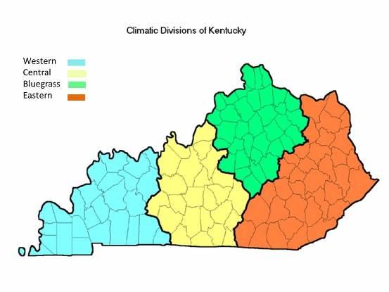
Admittedly, these divisions are somewhat arbitrary and they may not match entirely with your view of what region a given county or distillery is a part of. Take Jefferson county for example. It is in the Central climatic region while adjacent Oldham and Shelby counties are in the Bluegrass region. Louisville and Shelbyville are 40 minutes away but one is in Central and one is in the Bluegrass region.
Don't take these regions too seriously. They are just a way to segment a list of nearly 70 distilleries into more digestible, regional lists. It's intended to be a tool, like this website in general, that people can freely use to find the next local drink they're going to get. Whether it's at a distillery, brewery, winery, meadery, cidery, bar or even your house - we just want you to drink local, and we're here to help.